
Gadgets
How to plan the perfect road trip in Google Maps
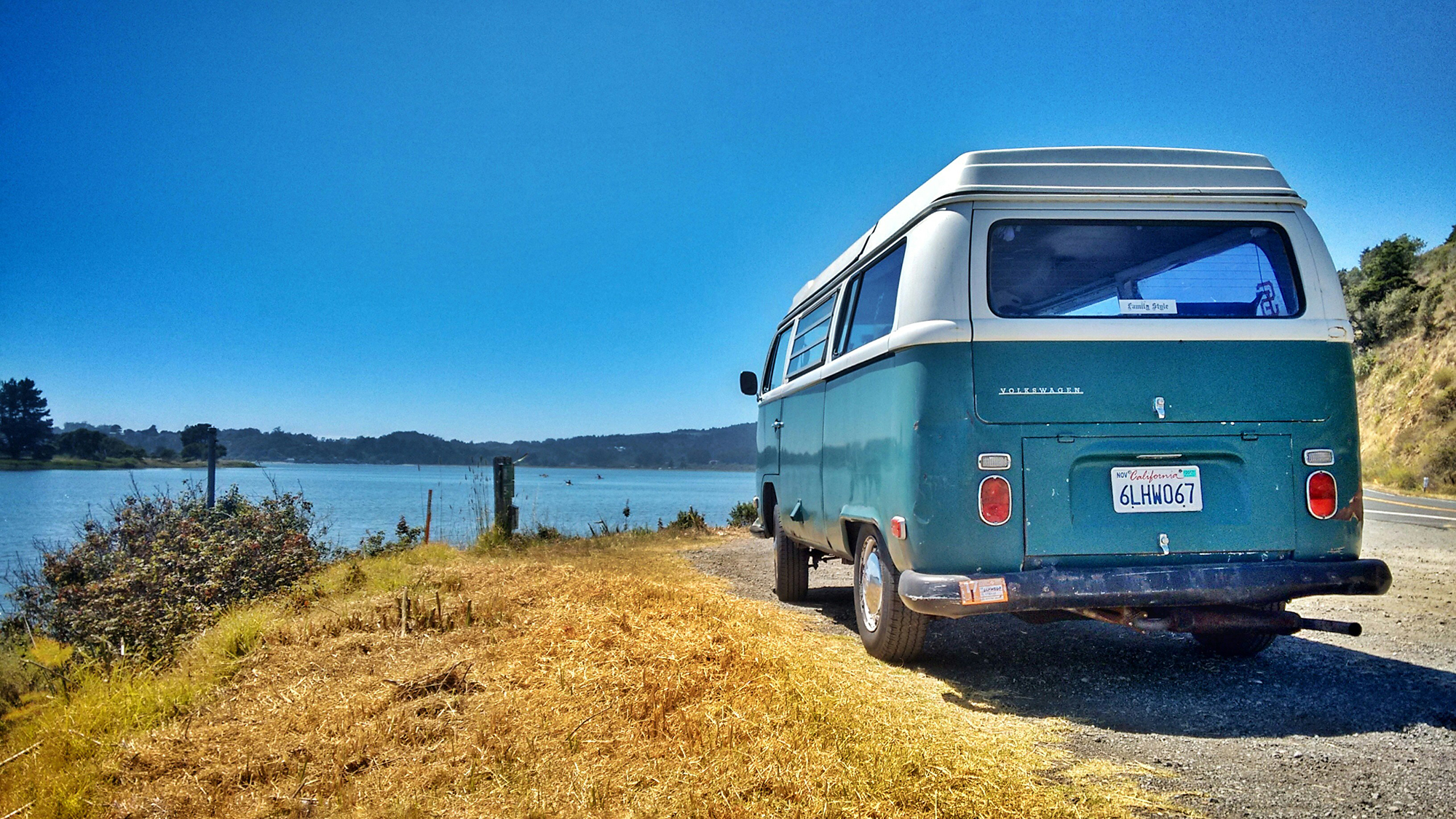
Google Maps offers more than just directions and reviews. It also has specific features to help plan road trips on Android, iOS, and the web.
These features include the ability to look up, label, and save places in advance, check future traffic conditions, and find places of interest along a route.
While we’ll focus on the web version of Google Maps for planning, the same features are available on the mobile apps as well.
Adding destinations and checking traffic
To add destinations and check traffic, click on a spot on Google Maps and select Directions to set a starting point for your road trip. Use Add destination to add more stops and rearrange them by dragging.
The estimated travel times are based on current traffic. Switch to Typical traffic to see future conditions and plan your trip accordingly.
You can share the estimated travel time link with others by clicking Copy link or save it for later use.
Find new spots along the route
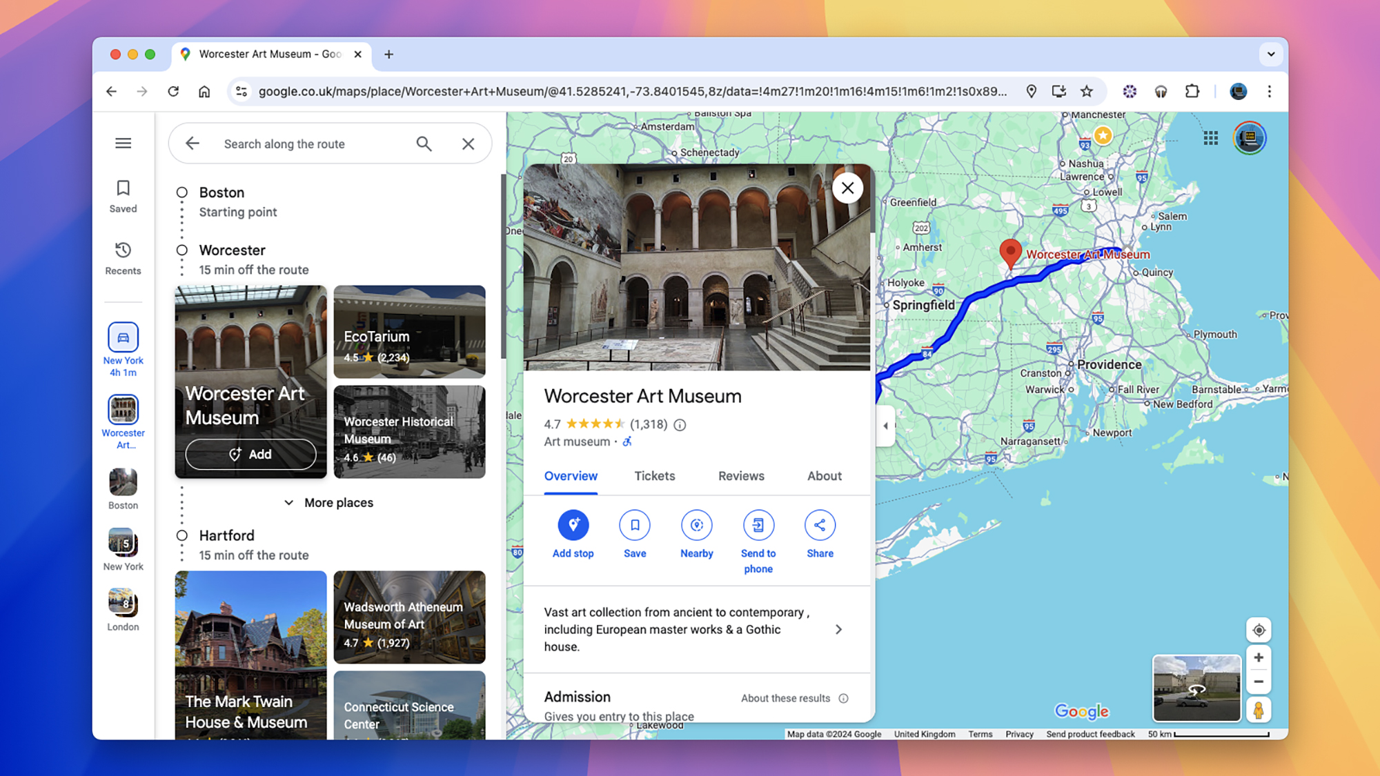
Google Maps now allows you to search for places along a route without losing your original route. Use the Search along the route box to find tourist attractions, hotels, and more.
You can also explore new places along the route in the panel on the left and add them to your trip.
Set up and share lists

Create lists of places to visit or attractions you want to see by saving them on Google Maps. You can add notes, remove entries, and share lists with your travel companions.
To share a list, click the three dots in the list, select Sharing options, and invite others to contribute.
More road trip tips
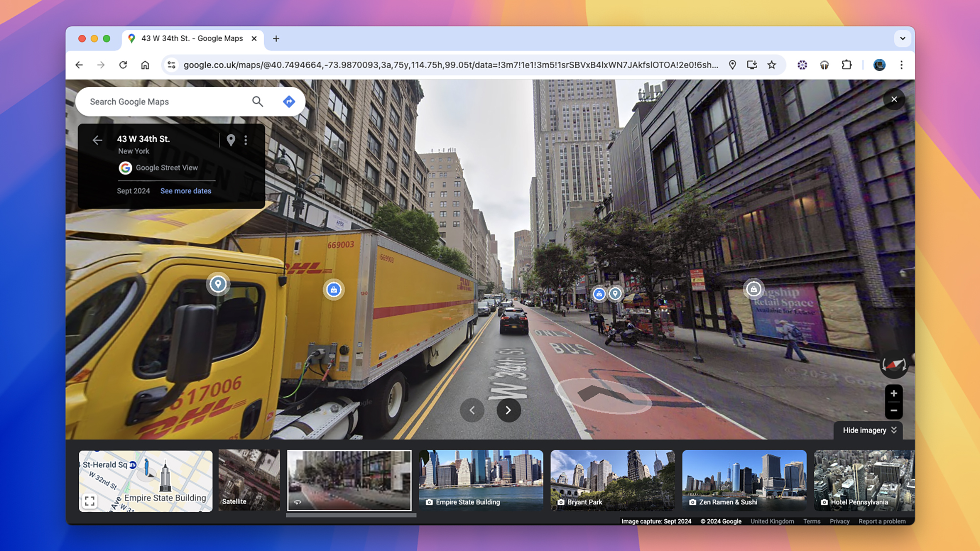

Don’t forget Street View inside Google Maps: Click any road on the map, then choose Street View to see how it looks at street level. You can use this to get prepared for difficult road junctions ahead of time, or to take a closer look at potential road trip stops.
Be sure to dive deep into all the details on the info cards for specific places. You can check out reviews, photos, opening times, menus, prices, and more besides—you’ll be thankful that you put in some research ahead of time if it means you don’t turn up somewhere to find it closed.
Finally, make sure you’re aware of all the layers you can show by clicking on the Layers button in the lower left corner: The Satellite view is useful for scoping out places, for example, while the Cycling layer shows you trails and unpaved roads, which is sometimes helpful for planning stops and hikes during your trip.
Win the Holidays with PopSci’s Gift Guides
Could you please rephrase that?


5 Amazing Benefits Of Stacking Toy

Nordic founders are taking bigger swings, and it’s paying off

5 Apps To Speed Up Your Google TV Device

Trump threatens ABC News for reporter’s questions on his family business in Saudi Arabia, Khashoggi’s murder and Epstein files

The Best Sunglasses for Travel + Must Have Accessories » Local Adventurer » Travel Adventures in Las Vegas + World Wide

This Silent Habit Might Be Sabotaging Your Career

The Four Types of Happiness: Which One Are You Living In?

Halloween Events in London 2025

Join the peaceful demonstrations for democracy

Cute and Thankful Sayings for the People You Love

Croatia to reintroduce compulsory military draft as regional tensions soar

Singapore Airlines CEO set to join board of Air India, BA News, BA

Supernatural Season 16 Revival News, Cast, Plot and Release Date

How Your Contact Center Can Become A Customer Engagement Center

Bangladeshi police agents accused of selling citizens’ personal information on Telegram
Google Pixel 9 Pro vs Samsung Galaxy S25 Ultra: Camera Comparison Review

The Criterion Collection announces November 2024 releases, Seven Samurai 4K and more

Fallout Season 2 Potential Release Date, Cast, Plot and News

15 of the Best Trike & Tricycles Mums Recommend

17 Signs You Travel A Lot
-
 Breaking News2 years ago
Croatia to reintroduce compulsory military draft as regional tensions soar
-
 Destination1 year ago
Singapore Airlines CEO set to join board of Air India, BA News, BA
-
 Gadgets1 year ago
Supernatural Season 16 Revival News, Cast, Plot and Release Date
-
 Productivity2 years ago
How Your Contact Center Can Become A Customer Engagement Center
-
 Tech News2 years ago
Bangladeshi police agents accused of selling citizens’ personal information on Telegram
-

 Gadgets10 months ago
Google Pixel 9 Pro vs Samsung Galaxy S25 Ultra: Camera Comparison Review
-
 Gaming2 years ago
The Criterion Collection announces November 2024 releases, Seven Samurai 4K and more
-
 Gadgets10 months ago
Fallout Season 2 Potential Release Date, Cast, Plot and News