Breaking News
As snow clean-up continues in parts of Ontario, intense squalls move south

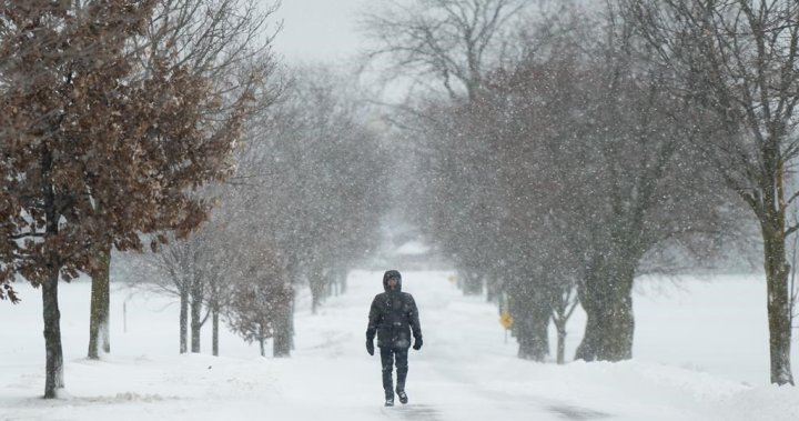
Snow squalls that covered parts of Ontario around Georgian Bay over the weekend are now moving south, with weather warnings and alerts extending from Collingwood to London and the northern outskirts of the Greater Toronto Area.
On Saturday, nearly a meter of snow swept off the Great Lakes and shut down a section of the Trans-Canada Highway. Over 30,000 homes were left without power in the aftermath of the storm.
Communities along the shores of lakes Superior and Huron experienced the brunt of the weather event and remained under a snow squall warning. Areas near Niagara Falls and Kingston were also under lake-effect snow squall watches.
Gravenhurst, located in the Muskoka region, was hit with 140 centimeters of snowfall and declared a state of emergency.
Global News chief meteorologist Anthony Farnell attributed the significant snowfall in parts of the province to the collision of warm weather from recent weeks with winter cold.
“It’s been a very mild and calm fall up until now and that has led to record warm water temperatures on all five of the Great Lakes, including Georgian Bay,” he said. “So, record warm water and now finally the arctic air is here and that’s the reason we’re having such intense snow squalls.”

Get daily National news
Get the day’s top news, political, economic, and current affairs headlines, delivered to your inbox once a day.
The snow threat is now moving further south, with Environment Canada issuing snow squall warnings and forecasting 15 to 25 centimeters of snow for communities along the edge of Lake Huron and the southern shores of Georgian Bay.
Squalls are also anticipated as far south as London, Ont., with the potential of up to 30 centimeters of snow falling on the western Ontario city by Tuesday morning.
A weather advisory for between five and 10 cm of snow was issued for Kitchener and Newmarket, as well as parts of Brampton and Guelph.
“An intense snow squall will move south across the area this afternoon and evening,” Environment Canada said.
“Brief but intense snowfall could affect road conditions and result in significantly reduced visibility. While most areas may only see a few centimeters of snow, accumulations in excess of 10 centimeters are possible for locations west of Orangeville to Kitchener.”
In Gravenhurst, cleanup efforts continued into Sunday.
OPP reported that emergency crews assisted people stranded in their cars on Saturday, bringing them to the powered Gravenhurst Town Hall amidst widespread power outages in the area.
Hydro One, the provincial utility, noted that the number of customers without power surpassed 60,000 by Sunday morning.
Ontario Premier Doug Ford pledged additional resources to aid the snow-affected town in a social media post on Sunday.
“We’re working closely with local authorities in Gravenhurst and across the Muskoka region to make sure they have everything they need to respond to yesterday’s snowstorm,” the premier wrote.
Farnell warned that the threat of more snow isn’t diminishing.
“It’s not going to melt, the cold air keeps coming right through next week and that means more snow,” he said.
— with files from The Canadian Press
© 2024 Global News, a division of Corus Entertainment Inc.
-

 Breaking News2 years ago
Croatia to reintroduce compulsory military draft as regional tensions soar
-

 Destination1 year ago
Singapore Airlines CEO set to join board of Air India, BA News, BA
-

 Gadgets1 year ago
Supernatural Season 16 Revival News, Cast, Plot and Release Date
-

 Productivity2 years ago
How Your Contact Center Can Become A Customer Engagement Center
-

 Tech News2 years ago
Bangladeshi police agents accused of selling citizens’ personal information on Telegram
-

 Gadgets10 months ago
Google Pixel 9 Pro vs Samsung Galaxy S25 Ultra: Camera Comparison Review
-

 Gaming2 years ago
The Criterion Collection announces November 2024 releases, Seven Samurai 4K and more
-

 Gadgets10 months ago
Fallout Season 2 Potential Release Date, Cast, Plot and News


